Showing posts with label bc. Show all posts

Tuesday, May 19, 2015

Springtime Westside action

With things firming up nicely on all three important fronts: schedule, snowpack, and weather, Cotton and I headed up Mt. W a few weeks back to grab turns in some previously unexplored terrain (for us, anyway). Having gotten some recent beta from a few other folks who have the luxury of mid-week trips, we decided to skin up the Ammo Ravine trail. With the forecast calling for 55F temps at the summit, we hoped to be speedy enough to drop in to Oakes before the sun baked it to complete mush, then proceed from there as the day allowed.


Though the Cog Railway parking lot was crowded, we essentially had the ART to ourselves, save a pair of groups on microspikes looking to hike up to the summit. We started our ascent under bluebird skies and the shade of pines, accompanied by the sweet music of the Ammonoosuc River. I've spent little time exploring this side of the mountain, and can say I was pleasantly surprised with the amazing views one gets for the first third of the hike. I can't count how many times I'd stop to take a picture, only to do the same five steps later when an even better opportunity came about. We finally decided this was the spot and grabbed a few posed ones for the wall at home:

Look at those shiny new boots!


Around halfway up the Ammo trail we transitioned to booting (though perhaps skinning would have been more efficient, given the postholing that went on) until we hit treeline. From there it was a smooth skin to the Lake of the Clouds Hut, where we ran into a few groups coming up from various other ascents. From the hut we traversed along the Dry River Trail to the edge of Oakes. We found a decent path somewhere in the central Gulf and skied in. The snow was heavy, but not a complete mess, and fortunately without much sluffage. (In hindsight, I think it's a better idea to summit Monroe, then ski from the top into Oakes.)

On the way up.
Cotton getting after it in central Oakes


From the bottom of Oakes, we skinned back out and found a quite place to eat lunch among the rocks. Cotton had leftovers from a family dinner the night before, so we feasted on gourmet pasta and lamb, washing it down with a pleasant local microbrew.

Skinning out
On a lunch break

After refueling, we decided to head to the summit and ski down from there. We followed the Tuckerman Ravine Crossover trail to the southeastern snowfields, then zig-zagged our way up to the top. After an obligatory summit pic, we skied back down the southwestern summit cone then across to Lake of the Clouds, then traversing to Monroe Brook. We were blessed with perfect spring snow and some mini-moguls on the way down MB. As an added bonus, we kept skis on all the way to the trailhead with only a few lurking hazards to nick our bases.

I've been told summit pics are required by state law.

Coming down the southwestern side


It was nice to get out and explore a new area, enjoy the day, and get a few turns. I'm excited to use this as a springboard to get into even more terrain in the coming seasons. Unfortunately, this might be the last of 2015 for me. Hoping next season brings as much snow as this one did!


Tuesday, February 17, 2015

Collines Bleues

Boston has the best snow in the country right now. Yes, you read that right. Stoked by the seemingly endless snowfall, Les Freres Huff et moi did some sliding in what is essentiall our backyard. Some summer scouting in a locale we frequent for hiking led us into the woods on an early morn. Despite the serious lack of vertical footage, we were able to snag some pow turns and get a nice tour in, at least, until the statie ticketed our car for "impeding snow removal". C'est la vie?


Brian


Matt

Sunday, January 25, 2015

Wa-Tastic

Excited by the fresh white stuff that fell locally (but curiously, not up North), we decided to make a quick hit of a local lost ski area we'd been eyeing in the offseason. A reasonable sub-alpine start had the our typical crew (and some recently made four legged friends) climbing shortly after morning's light.
Local = casual start.
Frenemies.
Though it appeared someone beat us to the punch the day before, it still looked as if there were goods to be had. Plus, said someone was nice enough to break trail.


Beautiful day in the neighborhood.

Decent coverage and open glades brought about a few whoops from the crew, as we ran a few laps. Despite the lack of coverage and somewhat bony conditions, we came away unscathed, in need of nothing more than a drop or two of ptex to mend the wounds. Well worth it in my book!

Cotton challenged Ginger to a race.
Getting a few laps of the surprisingly light and fluffy pow has our stoke replenished, just in time for what might be the biggest snow in recent history.


Stay tuned...

Monday, July 28, 2014

Firescrew, Mt. Cardigan

This is a rather delayed posting of a trip we took back in March on Mt. Cardigan. Having visited the area last year and taken on the prime packed powder (tongue-in-cheek) on the Alexandria Trail, this year we opted for the Duke trail, which heads up the more northerly Firescrew peak. Visions of this route from the trip last year indicated that, given enough snow, there was potential for some open, snow-field skiing. Fortunately, Mother Nature had granted us with a fair amount of snow. Unfortunately, it had gone through a nice melt-freeze and covered the entire snowpack with a skating-rink of ice. Nevertheless, we managed to summit and enjoy a pleasant lunch in the warm spring sun before slipping down the mountain. Here are some pics from our trip.


Shoulda packed the hockey equipment... 
Great view of Cardigan peak.
Good skiing in the right conditions.


Huff enjoying some recovery nutrition.


Cardigan looks to be a go-to spot in the future. It's within a reasonable driving distance and easy on the legs going up, with some solid skiing if there's powder. Looking forward to several weekend mornings here in the coming year.

Tuesday, February 18, 2014

Mt. Moosilauke

Following the brutal January doldrums, we finally got back on track with a string of classic winter storms.  A brief discussion for a day trip landed on Mt. Moosilauke.  We collected some info from various sources, and decided it would be a decent trip to attempt given the accumulations around the area and our interests in a new-to-us tour.

Moosilauke is draped in a long tradition of skiing, verging back on the Dartmout Outing Clubs early days.  If you're interested in reading more about it, both the DOC and Goodman's book have a nice summary of the rich ski culture surrounding the mountain.  It's so well known, that a less-than-outdoor inclined Dartmouth alum excitedly said to me "That's Dartmouth's mountain!" at the mere mention of it's name.  From our perspective, this seemed like a reasonable day tour, and despite it's 10+ mile distance, the total vert would be more than manageable.

In order to access the mountain in the winter, one must park either at the entrance to the Ravine Lodge road or at the base of the Carriage Road.  Either way, there's a decent flat run in before you start hitting contours.  Having parked and geared up at the Ravine road, we headed out on the 1.5 mile in-route toward our objective.  It was obvious from the line of cars, as well as the well packed skin track that we weren't the first to have this idea after the recent storms.

Ravine Road
Our initial plan was to ascend via Snapper to the Carriage Road, then skate the ridgeline to the true summit of Moosilauke.  The DOC does a great job of maintaining the area and trails are well labeled.  Several signs from the Ravine Lodge point climbers in the correct direction.  The Lodge itself is a thing of beauty, and though it is not open in the winter season, looks to be a great place to spend a night.  Almost makes me jealous of Dartmouth students...almost.

Posing with Moosilauke in background
Our trip up was rather uneventful.  The trail from the footbridge at the base of the mountain is fairly narrow, but had decent snow cover and was otherwise pleasant.  Snapper spits you out onto the Carriage Road, which is a bit wider (and thus better for the downhill).  From there the ascent travels up the eastern side of the South Ridge until summit hopping to the peak.  As we neared the top it was obvious the wind was moving pretty quickly above tree line.  Though most of the ridge was sheltered by short evergreens, the snow revealed numerous signs of wind-induced movement over the past few hours.

Carriage Road action shot
We opted to layer up and throw on our hoods just before hitting the treeline.  The summit snowfields apparently offer some decent skiing in a good season.  It was obvious from the get go that the windward side was pretty well scoured of any snow - mostly frozen hard stuff and rocky obstacles remained.  In scouting the lee side, I managed to find some of the vagrant snow and sufficiently bury myself about waist deep in a pile of it.  Unfortunately, the varying wind patterns and exposed trees didn't leave much room for carving up the cone, so we opted to summit and get out of dodge.

Gnarly summit
Cotton and Huff. It was windy.


As with any trip, good planning is important.  We had agreed to take our aforementioned route up with the hope of descending via Gorge Brook trail.  Despite the best of intentions, some outdated maps and faulty information from some other travelers led to a rapid change of plans.  Turns out, we missed the trailhead at the summit by about 10m (see GPS below).  Given that had at least scouted our previous route on the way up (and knew where it was!), we headed back down the way we came.

Just missed it.
The ski down was pleasant, although far from noteworthy.  The Carriage Road is almost wide enough to put some turns together, but it never quite gets there.  Quick feet and the occasional snowplow are the name of the game.  Once on the Snapper, it's true survival skiing.  I kept Cotton just barely in sight ahead of me in an effort to prevent any impact if he stopped short around a corner.  Despite the narrow path, it was a fun trip down to the Ravine Lodge.  We realized we'd need to skin back up to make the trip back to the car easy.  In the transition, we ran into a couple and their nice puppy, who apparently had lost his leash on the trek uphill.  Fortunately, Huff keeps 30 feet of paracord in his pack at all times and was able to fashion a leash for them.  Unfortunately, he didn't offer to have the dog pull us back to the car in return.  Needless to say, they were grateful nonetheless.

This looks familiar...
While the ski trails may not rival some others we've explored, certainly this is a great trip. And we learned a few lessons: double check to make sure you have updated maps (USFS are apparently more current than USGS) and you can't rely on others to guide you to the trail.  If one considers it more of a ski mountaineering objective, it's well worth the effort - a trip up Moosilauke puts you above 4000ft on a classic New England summit with incredible views in all directions.  Hopefully next time there's a bit more snow to enjoy once we're up there.  

Summary:


Thursday, January 9, 2014

Thunderbolt

Given the recent fortune of fresh snow falling throughout Massachusetts, the usual suspects made a game-time decision to head out to the Berkshires and sample what Mt. Greylock had to offer. The recent storm left the Boston area shut down, with some suburbs getting over 2 feet of light-weight fluff. Native Vermonter Huffman commented on the ridiculousness of the city's shutdown, but I didn't hear him complaining about his "forced" day off.

Unfortunately, the western part of the state didn't luck out quite as much, recording approximately 8 inches of good stuff.  With the recent fluctuations in weather, we weren't exactly sure what to expect as far as snow cover was concerned.  Nevertheless, with Cotton's newlywed bride Pearl offering us a place to stay at her family's house, it was hard to pass up on the adventure.  Better yet, we were graced with a fantastic dinner and some fine local ales to fuel our legs the night before our first official tour of the season.  Proximity to mountains and delicious food - can one ask for better hospitality?

The pre-dawn departure was met with brutal cold.  I think we recorded a -17F while driving up to N. Adams from Canaan. Otherwise the weather couldn't have been better (I say this only partly tongue-in-cheek), the sky was clear and the sun was shining.  I sniped a quick shot through the car window of the sunrise, which never ceases to impress me.


While I've backpacked around Greylock a few times, I've never visited it in the winter, and was excited to revisit one of my first explorations into outdoor adventure.  Additionally, the history of the trail and it's ski culture speaks for itself.  The Thunderbolt Ski Runners maintain the trail and host an annual race, which involves both a hike to the summit and a timed race downhill.  From what I read, the course record of just over 2 minutes was set in the first half of the 20th century, and stands to this day.

By the time we parked and geared up, the weather had warmed up to a balmy -6F, and we were off.  Our early morning departure may have been cold, but the lack of skintrack in front of us was a worthy reward.  Some remnants of a visitor from the true powder day one day earlier were enough to guide us up the trail, along with some questionable map reading by yours truly.


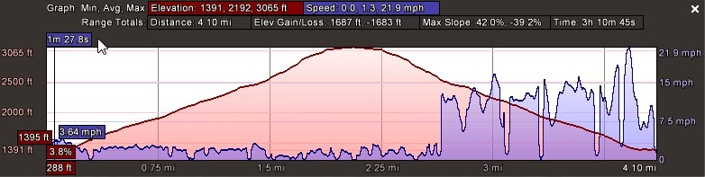
The trip up is rather pleasant.  The start of a trail is just that, a trail about one person wide, and follows along the bank of Hoxie Brook before ascending the eastern face of the mountain.  Once the vertical starts to kick in, the trail opens up to a comfortable 20ish feet of skiable width.  Thinking back to my first trip out to Cannon last year, my legs and lungs were in much better shape for this season.  Turns out experience matters.  Nevertheless, we didn't meet the 2 hour ascension time that "someone in shape" can accomplish this tour.
Brrrrr
We enjoyed a beer and the classic mountain meal of hard meats and cheeses in the warming hut up top.  This is a nice feature, espcially on a cold and windy day. There are even two wood stoves with which to make a cozy atmosphere, if one was so inclined.  A DCR worker stopped in to drop off some trash bags and we chatted with him for a bit, then deskinned and headed down the way we came.


As far as the down goes, Thunderbolt has a lot to offer.  Wide enough to string together turns, with many changing pitches and bends.  It's a lot of fun, even if you're competing with the limited snowpack and numerous hidden obstacles as we were.  We were graced with some powder turns met with the occasional scrape of a rock underfoot.  At least two of us lost a ski to a root at some point on the way down, but it's a small trade-off for the fresh snow.  During the descent, we passed at least 15 (or 57, if Huff is counting) people who were on their way uphill.  Guess we picked the right time to hit the trailhead.

Nice panorama by Cotton
Thunderbolt will certainly require another (or multiple) visits this season, especially if we are graced with a bit more snow.  Thankfully, Pearl has extended an invitation for us to return, so hopefully we can realize this goal.  Thanks again to our hosts for a great time and some needed coffee for the ride home.  Unfortunately, as I write this we're staring in the face of another January thaw.  Only in New England can we have subzero temps followed by a 50 degree weekend.  Keep your fingers crossed it doesn't last too long.